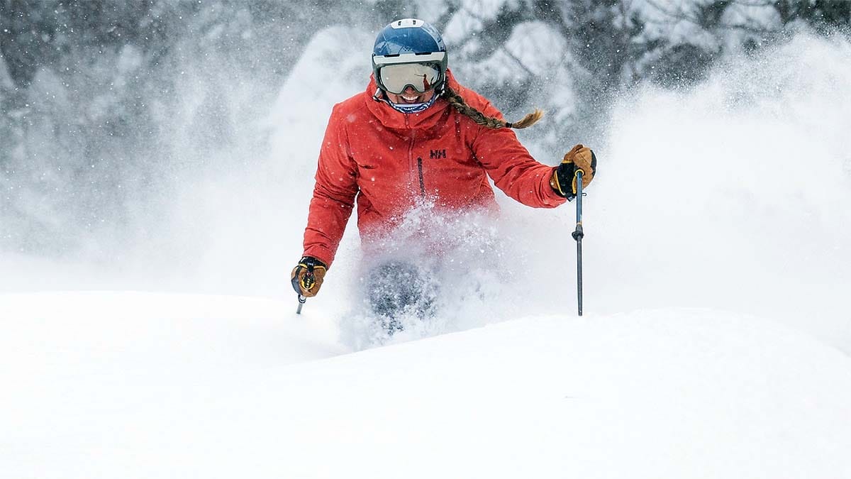
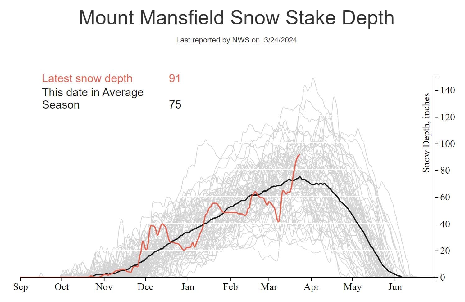
Oh the chants that winter was over at the start of March, "hang them up", "it's all going to melt", "the ski season is over". Listen, just because you might have given up doesn't mean that everyone else should. Dumping on the ski season around here is like going to a Taylor Swift concert and yelling how bad of a singer she it. Not cool! It's also not true! We have a bunch of ski areas that received over 40" in just the last 7 days! Some have received over 70" in just the last 2 weeks! How does the Mt. Mansfield stake look? It looks damn deep, so damn deep that there was frickin' avalanche danger, even inbounds! Yeah, winter is over my ass! It's literally Miracle March, the best and deepest snow across a wide area since November 2018! The ski season is not over!
SNOWOLOGY is for people who love snow, whether it is deep and fluffy, or near transparent and solid with a hint of blue. On February 28th we not only covered the coming warm up, we also covered the extended range outlook and there were strong signals for the last half of the month to become cold again with troughing through the Northeast and a favorable storm track. Well guess what, it confirmed!

Never give up on the season at the start of March folks! That's just lunacy. North of the Albany latitude it may even be the snowiest month of the season on the mountains! It's late March now and snow chances are lower, but we've got two shots in the next 8 days for winter storms. No promises though, there's nothing solid yet, but I'm not done looking for opportunities nor should you.
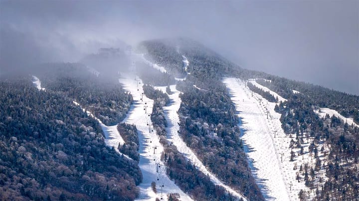
Now if you were out this weekend I'm just preaching to the choir. Sunday was one of the busiest days of the season for many ski areas. It seems that some of the naysayers got the pow fever also. This was widely the best weekend of the season north of the Albany NY latitude! Now let's look at some beautiful NWS interpolated snowfall maps.
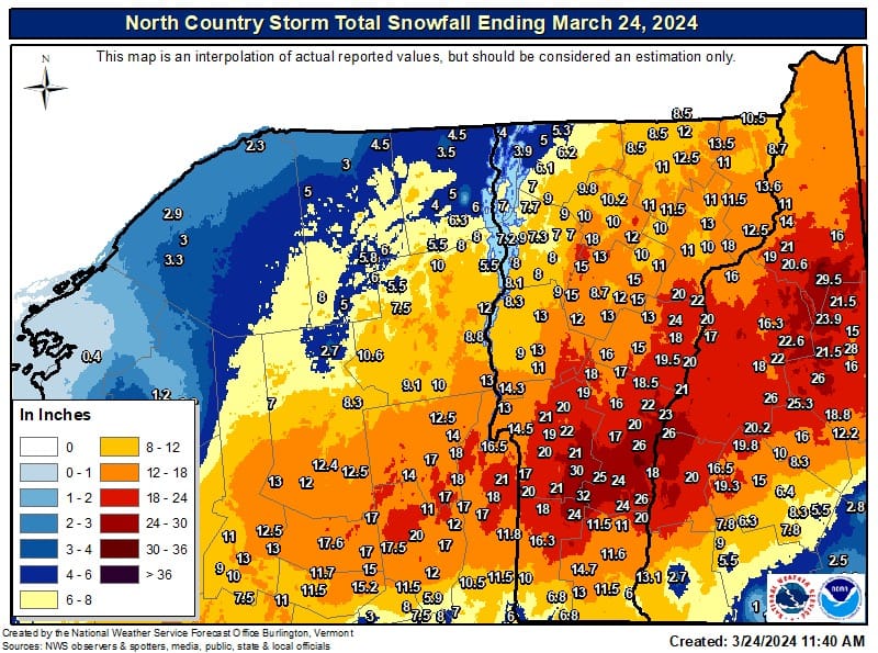
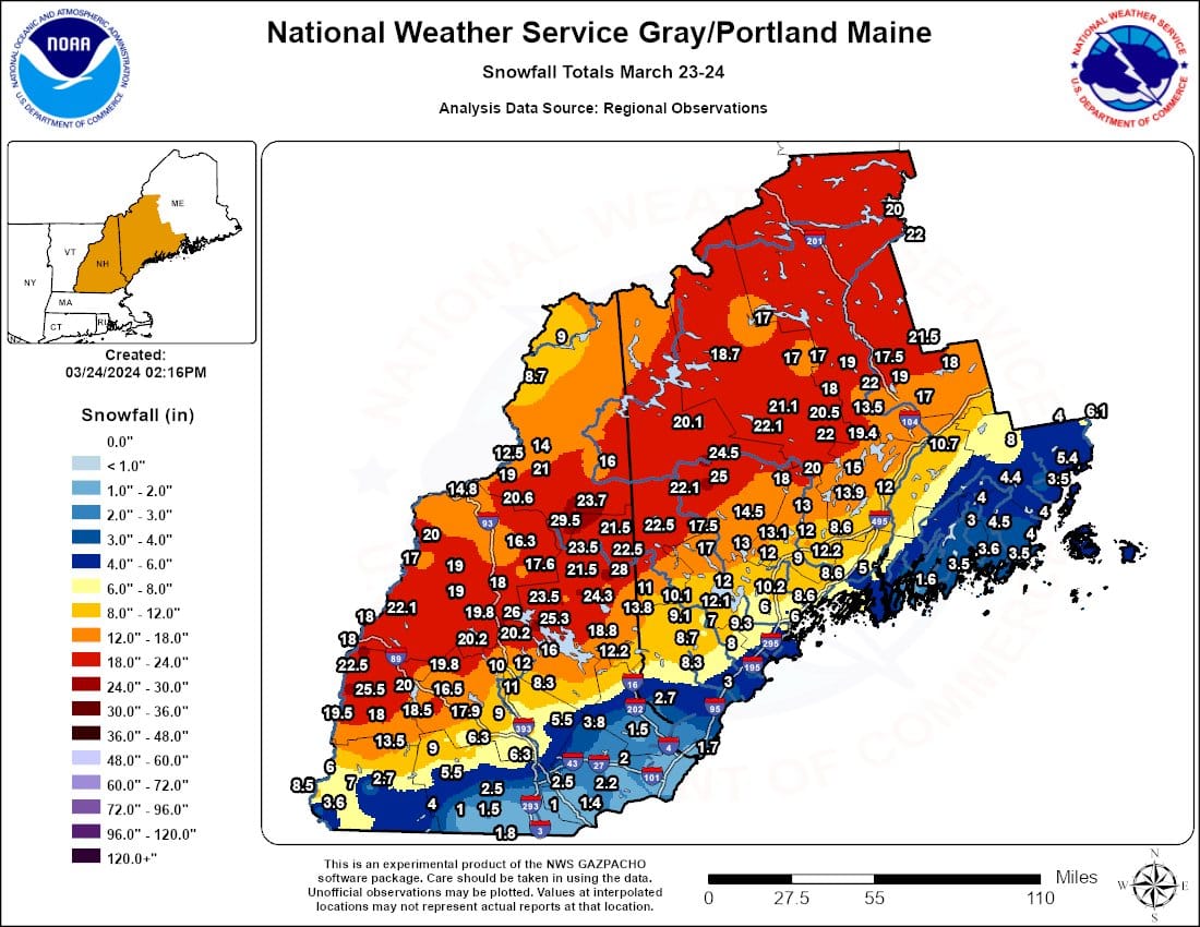
NWS uses multiple forms and methods of interpolation and the one on the left came from NWS Burlington and the one on the right from NWS Portland/Gray using different inputs and techniques so they don't match perfectly. These take ground measurements and mix that with data describing terrain to fill in the maps. Those numbers on the maps are all reported measurements that they collected, mostly from towns in valleys where there is less snow. These interpolated maps are imperfect and frequently underestimate the snow on the mountains, but they are a great guide for the distribution of snow and and they generally set a baseline.
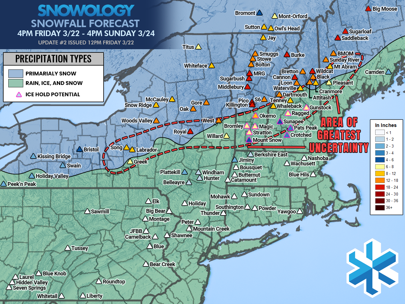
Here are the full storm reports from across the Northeast where there was notable amounts of snow.
|
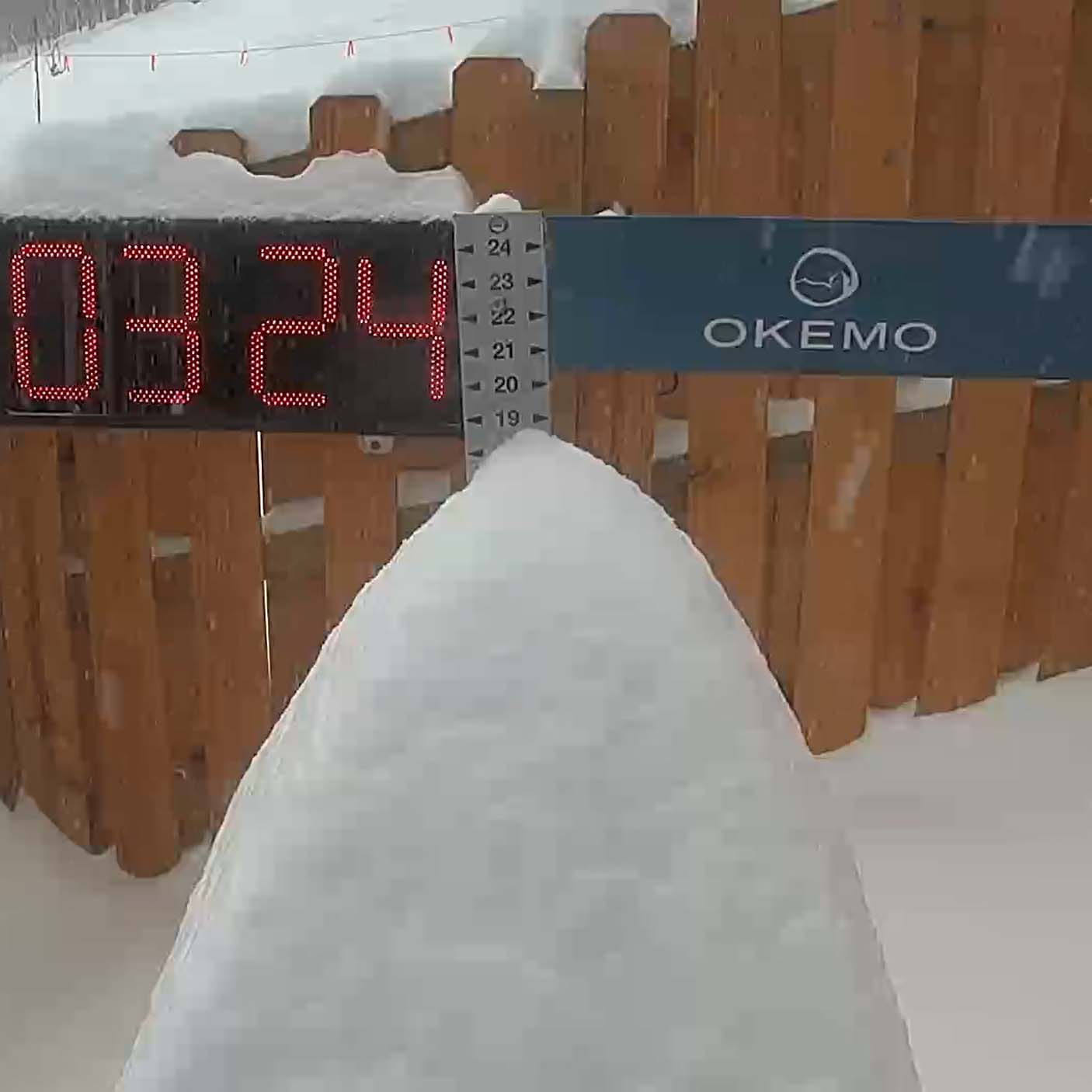
NEW YORK Gore: 14" Greek Peak: 6" McCauley: 8" Royal Mountain: 17" Song: 12" Titus: 4" West Mountain: 20" Whiteface: 11" Windham: 5" Woods Valley: 9" VERMONT Bolton Valley: 16" Bromley: 30" Burke: 18" Jay Peak: 16" Killington" 24" Mad River Glen: 18" Magic: 30" Middlebury: 18" Mount Snow: 16" Okemo: 25" Pico: 24" Saskadena Six: 24" Smugglers' Notch: 13" Stowe: 11" Stratton: 28" Sugarbush: 17" |
NEW HAMPSHIRE Attitash: 25" Bretton Woods: 28" Cannon: 30" Cranmore: 23" Crotched: 6" Gunstock: 14" Loon: 26" Pats Peak: Ragged: 20" Sunapee: 22" Waterville Valley: 30" Wildcat: 30" MAINE Black Mountain of Maine: 24" Mt. Abram: Pleasant Mountain: 20" Saddleback: 21" Sugarloaf: 23" Sunday River: 36" EASTERN TOWNSHIPS Sutton: 8" Owl's Head: 8" Mont Orford: 12" Bromont: 14" |
Some are a bit high while others are low. The mixing occurred during the daytime so most ski areas measured before the changeover and then again after the changeover meaning that actual accumulations were not missed with this storm, but where it mixed it did not feel like the full depth. Big storms that coincide with weekends also tend to get measured more aggressively.
Here's the final SNOWOLOGY Snowfall Forecast map for this storm from Noon Friday as well as the Friday evening update from the NWS.
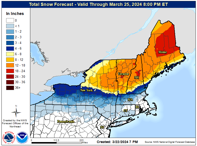
Great snow brings me plenty of love, it's almost cheating honestly, but this wasn't the best forecast of the season 24 hours out. In VT, NH, and ME I did miss the changeover line by about 25 miles and that's more than I'm used to. I was also purposefully conservative in this area figuring that mixing would settle the snow and it is better to be conservative in a changeover situation because it sucks getting skunked! Some of the deepest snow was in fact seen in this area because it was where flow from the south was running into the cold boundary it causes lift and instability, and lots of precipitation. Moving that line south caused excessive amounts of snow just beyond the boundary.
So what happened? Keep in mind the storm was always going to do exactly what the storm was going to do. The storm didn't change, but the modeling did. Models had a terrible time with this system and I even skipped the first snowfall forecast because there was zero agreement and the mix line in one model was reaching all the way into Quebec. I was forecasting a changeover line further south than all of the models were showing at the time. I feared the NAM3K was possibly realizing its warm bias when there is very strong southerly flow (it seems to not do very well with dynamic cooling in heavy precipitation). This was in fact part of what happened, but the big difference was the storm ended up stronger and therefore colder than models saw until it was already happening. The trough dipped further and the storm formed a new low and that helped disrupt the warm flow at the lower levels from the south and the cold air was reinforced. The snow was also very fluffy close to the changeover line and of course more so beyond.
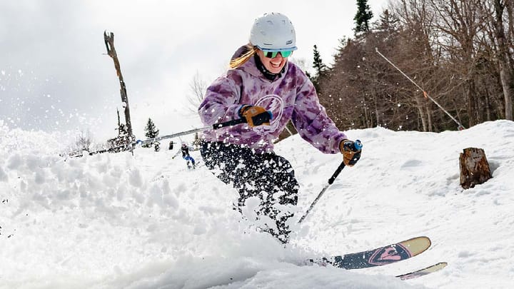
I nailed NY solidly, but that part of the storm happened before things started amping up. The persistent sleet and freezing rain only reached Mount Snow in VT with a very short-lived push north as far as Bromley, and there was an overperformance of snow prior to the changeover also. This continued in NH and ME with mix line further south than predicted, and also more intense snow than was modeled anywhere. Some legitimately broke 30". There was solid verification of that in S-VT, though not so much in NH and ME. The snow did drift however, especially in that focused band at the end with 3" per hour rates that was the icing on top. Then the skies cleared and the temps stayed cool, and Sunday became hands down the best powder day of the whole damn season! Hallelujah!
This wasn't a nor'easter, it was a combination of a weak slider, an atmospheric river pushed due north by the Subtropical Jet Stream, a small coastal low, and an anafront sort of setup which are notorious for both copious amounts of ice and snow. The timing of everything was perfect for those in the northern areas.
Watch out for the sticky snow early this week. It needs to cycle above and below freezing a couple of times before it stops being sticky, but by Thursday we should have some really nice natural corn to slide on where the snow is deep.
Knowledge Is Powder!
-- Matt
Comments ()