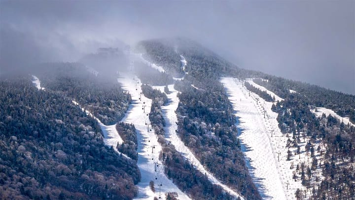
Well, the two week on and off powder party may have come to an end for the time being unless we can get a little lucky on Friday, but all is good because most ski areas that tend to operate into April and beyond have added between 2 and 6 feet of snow this month and at least 14 ski areas made snow in the last week including Blue Mountain, Montage, Holiday Valley, Windham, Greek Peak, Royal Mountain, Catamount, Berkshire East, Wachusett, Stratton, Killington, Loon, Sunday River, and Sugarloaf! We're finishing up strong!
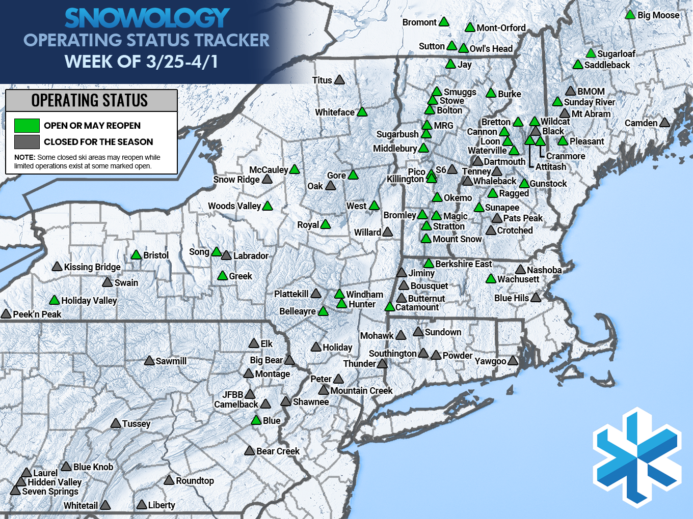
Here's a map of everyone who is planning to operate through Sunday, though not everyone in green has verified that they will make it and some mountains have limited their operations mid-week. Always check with the ski areas for verification and hours of operation.
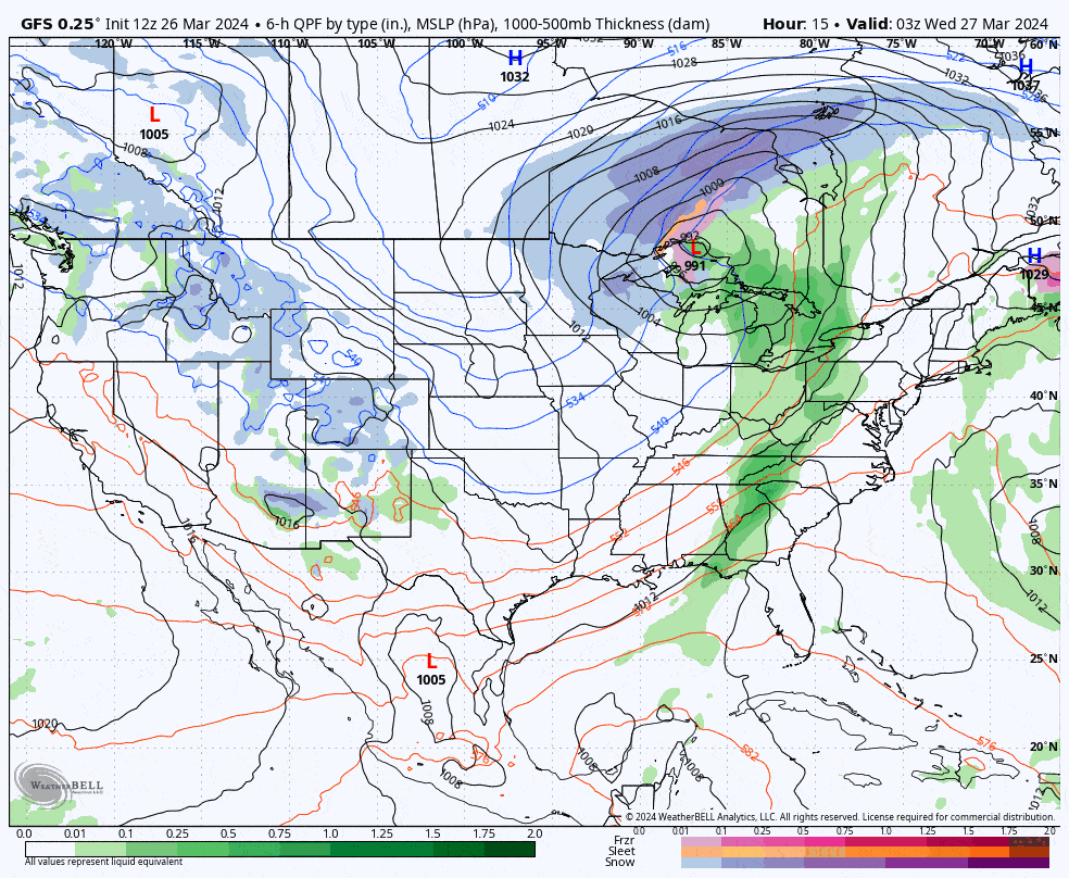
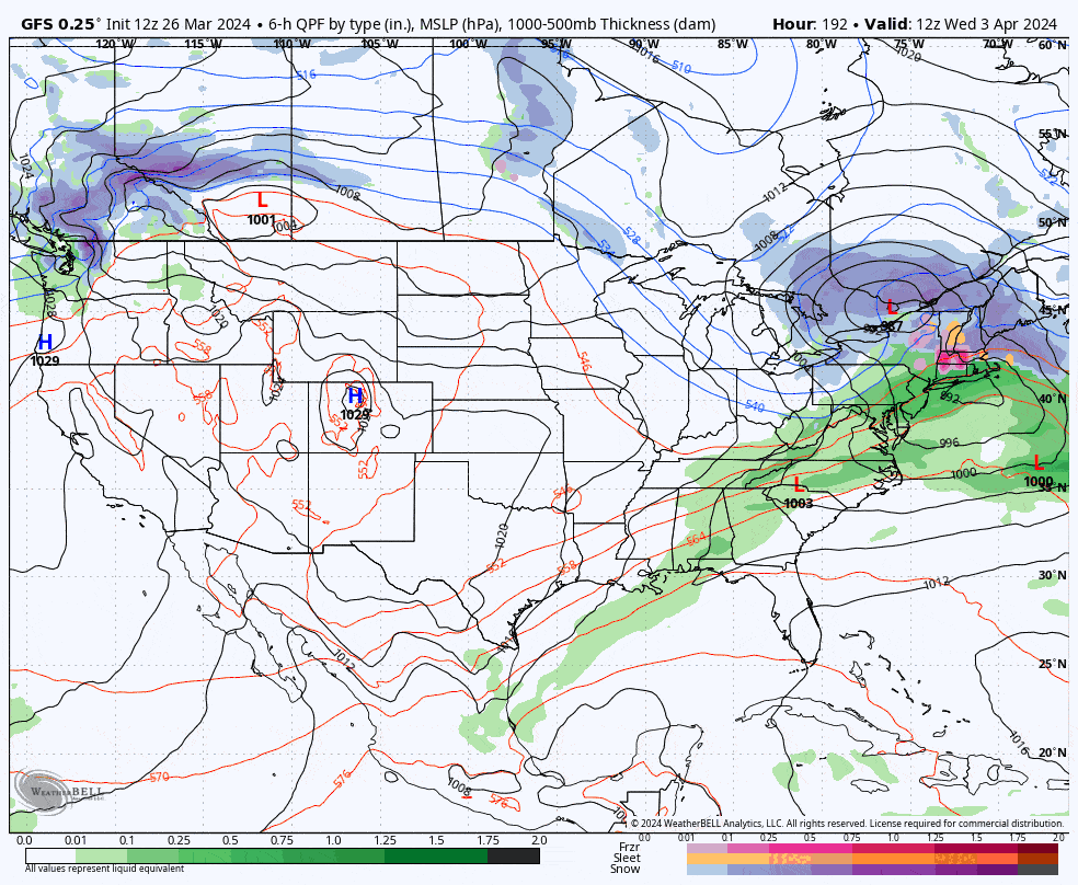
We have just 2 systems of note through Monday, but the first system has impacts at least Tuesday through Thursday, possibly also Friday with a chance of notable amounts of snow in at least part of the region. The next system comes in Sunday though it is not guaranteed and it will likely be light with both a little rain and some snow. Here's a loop from the GFS showing Wednesday through Monday.
I'm going to walk through the Precipitation Outlook with an update on the storm potential Friday, the Temperature Outlook, and then the Wind Outlook. I also am going to issue a quick Storm Watch for next Tue-Wed that is not paywalled, though everything else is just for our subscribers.
Storm Watch: Tue-Wed 4/2-3
Models have been playing with this system for a while and the GFS, which tends to latch onto actual storms earlier than other models, has been increasingly consistent over the last 3 days in seeing a storm form. Here's an animation of what the GFS, ECMWF, and GEM models show next Tuesday at this time.
This has big storm potential. Multiple waves of energy will be moving along a boundary at at some point the boundary will form a trough and will likely amplify one of these waves. This could create anything from a cutter (mostly rain), to a triple point low (snow favored in Northern New England), to a coastal storm (widespread snow, though likely heavier in New England).
A storm of some form is 90% likely to impact the Northeast, and after reviewing ensembles and using my brain a little, I would give us a 40% shot of there being some notable widespread snow. There's solid potential in this system.